")
")
Roadside Infrastructure Testfield Aachen (RITA)
Our RITA test field comprises two platforms: one for stationary (sRISU) and one for mobile (mRISU) roadside infrastructure sensing. The stationary infrastructure units are located at Campus Melaten, while the mobile units can be deployed at relevant sites as needed.
Stationary Roadside Infrastructure Station Unit (sRISU)
sRISU is a stationary roadside infrastructure platform that allows to collect and process traffic data to develop and validate algorithms for automated and connected mobility.
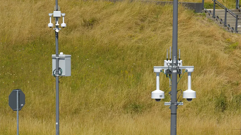
Sensors
- 2 PTRZ Cameras
- 2 ToF Lidars
Connectivity
- ITS-G5 / C-V2X
- Dual-Active 5G/4G
- PTP via GNSS
Compute
- HPC GPU Linux Workstation
Software
- Containerized In-House ROS2 Software Stack
- Software Deployment and Operation via Kubernetes
Mobile Roadside Infrastructure Station Unit (mRISU)
mRISU is a compact and agile roadside infrastructure platform that allows the flexible deployment of functions enabling cooperative and connected driving at locations of interest.
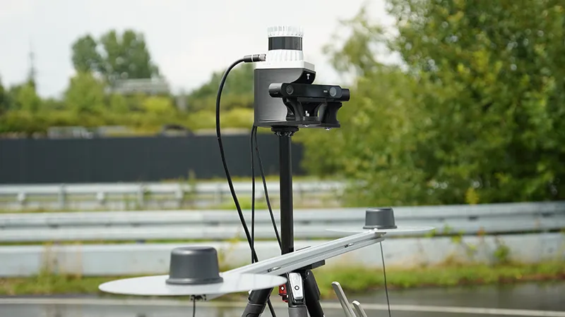
Sensors
- 2 Stereo Cameras
- 1 ToF Lidar
Connectivity
- RTK GNSS
- ITS-G5 / C-V2X
- Dual-Active 5G
Compute
- Embedded GPU Linux SoC
Software
- Containerized In-House ROS2 Software Stack
Contact
Lukas Zanger M.Sc.
+49 241 80-25630
Email
Privacy notice
If you would like to learn more about data protection when collecting video and image files in public road traffic for research, development and testing purposes in research projects, click here (german).
![]()
Service
Cooperations
Address
Institute for Automotive Engineering (ika)
RWTH Aachen University
Steinbachstraße 7
52074 Aachen · Germany
+49 241 80 25600